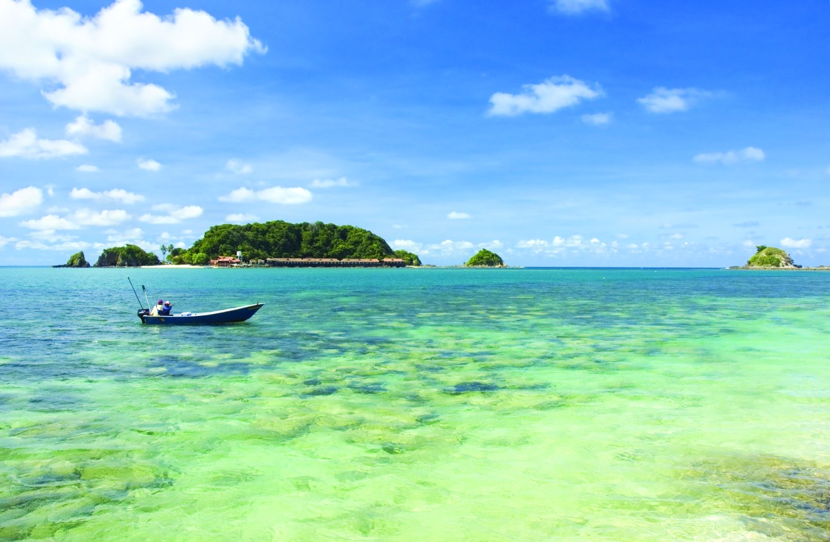
Paradise sometimes has a dark side.
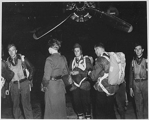
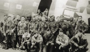
THESE MARINES had never been in combat. Their landing on little Tulagi island in the Solomons would begin the first American land offensive of World War II. Tulagi, 20 miles north of Guadalcanal in the shadow of the larger Florida Islands (now the Nggela Islands), had been the British capital of the Solomons before Japanese troops occupied it in March 1942. The island’s small harbor and nearby seaplane base had to be taken so that the invasion of Guadalcanal and its airstrip could proceed. On August 7, 1942, the 1st Marine Division landed on Beach Blue at dawn. The Americans conquered Tulagi and the nearby islets of Gavutu and Tanambogho in three days, while the horrific fight for Guadalcanal was not won for six months. The U.S. Navy then utilized Tulagi throughout the war as a base for PT boats, a repair harbor, and a 20-bed hospital site.
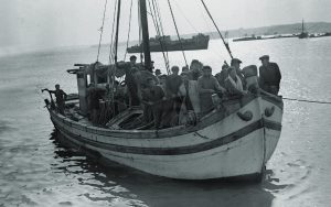
Tulagi is today a slow-moving place of 1,200 souls with one unpaved road around its shoreline. The PT base is long gone, but a modest fishing-boat dock and ship-repair facility remain. The only way to reach Tulagi is by boat from the city of Honiara on Guadalcanal, which is now the Solomons’ traffic-choked capital. Traces of the brief combat of more than 75 years ago are few, but during a recent visit I found several unmistakable remnants that still had the capacity to transport me back to those early days of the Pacific War.

The U.S. invasion of Tulagi was a complete surprise to the 1,500-man Japanese occupation force. After a naval bombardment, 1,000 U.S. Marines came ashore on the southern side of the rectangular island less than one square mile in size. There was no immediate resistance. The Marines moved up a draw just inland from the beach and charged southeast along the hilly spine of the island. A second unit moved parallel along the northern coast, where the village of Sasape and the port facilities were located. A third unit briefly reconnoitered to the west. At a large coastal rock formation called Hill 208, and then along this central hilly spine, the Marines encountered Japanese fire and resistance. Natural ravines and a manmade pass constructed in the 1930s called the “Cut Place” bisected the spine and provided inland defensive barriers for the Japanese. But the next morning the untested Marines moved inexorably along the hills, across a flat cricket field, and around the ravines. They eliminated dug-in positions and killed virtually all the Japanese who did not escape by sea north to the Florida Islands. The startled Marines even faced the first suicidal “Banzai” charges of the war.
About 3,000 yards east of Tulagi, and within easy view, sit the tiny twin islets of Gavutu and Tanambogho. These hilly dots had long been utilized as a Lever Brothers coconut plantation. In 1942 the Japanese built a 500-foot-long stone-and-wood causeway to connect these islets and used them as a seaplane base. A few hundred Marines landed at Gavutu’s concrete dock, and during the battle they both charged and retreated across this causeway. The Japanese had dug into the modest hillocks on the islets and poured murderous fire into the landing parties. U.S. tanks and reinforcements, arriving a day later, eventually secured these objectives by the end of the third day of fighting. Marine casualties on Tulagi, Gavutu, and Tanambogho totaled 144 killed and 194 wounded. An estimated 1,400 Japanese were killed, 70 escaped to the Florida Islands, and about 20 were taken prisoner.
Over 75 years after this short yet vicious battle, our small expedition ship anchors offshore of Tulagi. Four members of my family ride an inflatable boat into Government Wharf, now used for small fishing craft, on the northern side of the island. No one is there to greet us. So we walk southeast on the narrow, unpaved, tamped-down dirt road that circles the island. Light ocean breezes waft the scent of seawater, palms, and wildflowers as we stroll. Not much is happening except that a beat-up old freighter is being noisily repaired in a dry dock area. We turn inland through the deep Cut Place ravine (now called Tulagi Pass) and look up to see that there is only one rusty, flimsy walkway across the top of the ravine to connect the two halves of the hill that runs down the spine of the island.

After the road traverses the ravine, it crosses the site of a brief Japanese counterattack over the former cricket field and then winds around into Bukalonga village, on the island’s south side, which did not exist in 1942. There are a couple of trucks parked among the wooden, concrete, and metal homes. We find a small store that sells Coca-Colas and an outdoor fish market. By now the local people realize that visitors are in town, and many come out to look at us. Friendly waves and hellos are exchanged. One nice lady offers us betel nuts to chew on. (My advice: DON’T—these stimulants are pungently sour and bitter.) As we amble along, we pass a small school. The kids look impressive in their spiffy school uniforms.
We head northwest toward Beach Blue. Around a bend in the road to our right, a large boulder marks the rock wall edge of Hill 208, where U.S. troops first tasted offensive land combat in World War II. It looks pockmarked. Upon closer examination, I’m amazed to realize that these holes actually hold naval and aerial shells from 1942, still embedded in the hard granite rock. Farther along the road we come at last to Beach Blue, where the uncertain Marines landed so many years ago. The narrow beach, covered with palm fronds and seashells, looks small and insignificant. I try to imagine how different it must have looked to the Marines, after the intense shelling, as they trotted across the sand to the draw just inland. A sheltered concrete slab stands on the beach to commemorate the landing. We approach the slab and see a spot that likely once contained a memorial plaque, but it is gone, probably filched years ago.
School lets out, and we notice that the schoolgirls are playing some kind of game on the beach. When we approach and smile, the girls show us how they have tied live wasps to strings and are leading the wasps around like dogs on leashes, only in the air. This unique recreation presents quite a contrast to our mental images of the lethal fighting that occurred nearby.

The draws across the island and up its spine are visible from the beach. Up along the high ground itself, there is no evidence of the fight. The Cut Place ravine renders inaccessible the high southeast corner of the island where some fighting took place; the unstable walkway discourages any attempt to cross. So we walk back the way we came, through the bottom of the Cut Place, and then up the northern coast. Past Government Wharf and a closed hotel, I stop to consult an old map of Sasape and endeavor to find the site of the navy’s post-battle PT base. Farther north along the road is a series of dilapidated but still functioning docks. Finally, at the northern edge of these docks I locate a short trail leading to a series of connected, crumbling concrete piers that indeed once housed the base. At the former entrance is a battered metal fence. And lying upside-down on its side in the weeds is an old fence gate. It reads, in metal letters: “Tulagi Base.” I wonder why this artifact is not better preserved, perhaps in a naval museum someplace.
The weather is stifling hot, but the ocean is calm. So we hop on a “tinny”—a small aluminum boat with an outboard motor—and head for the islet of Gavutu. We pass through a reef to land at the war-damaged former Lever Brothers’ concrete dock. The uninhabited islet is eerily quiet. A bullet-pocked concrete storage shed still stands near the dock, but there is little else. The one-time Japanese-held Hill 148 on Gavutu is overgrown, eroded, and impassible. I then try to locate the famous causeway to the nearby islet of Tanambogho. I find its crumbling remains and start to wade out along its ruins. Quite suddenly, a distinctly unfriendly large saltwater crocodile leaps partway out of the water toward me, seriously discouraging any further exploration toward Tanambogho. The lesson learned is that the Marines had to contend with far more than just the armed and hidden Japanese troops.
For most of their history, Tulagi, Gavutu, and Tanambogho have been quiet, peaceful, beautiful tropical islands. For three violent days in 1942, this bliss was upended by the intrusion of foreign armies determined to annihilate each other. Today another foreign power covets Tulagi: China’s aggressive investment in the Solomons culminated last year in an effort to buy all development rights to the entire island. In October 2019, following local protests and international scrutiny, the Solomons’ government scuttled the deal. The little island continues to make world news. ✯

WHEN YOU GO
Getting There
Occasionally small cruise ships tender off Tulagi, but the best way to get to the island is by charter boat from Honiara on Guadalcanal (80 minutes away by boat). Make arrangements at the Solomon Kitano Mendana Hotel or the nearby Point Cruz Yacht Club (tel +677 22500). Your charter boat can also easily take you to Gavutu and Tanambogho, just 3,000 yards east of Tulagi. There is no motor transport on Tulagi, so bring comfortable shoes and be prepared to walk.
Where to Stay and Eat
There are two motels on Tulagi—the Vanita and the Raiders—which cater mostly to groups of Australian divers, and which are often closed. You can explore the whole island in one day, however. I recommend staying at the Solomon Kitano Mendana Hotel in Honiara and using it as your base of operations. Bring food and drink for the day trip to Tulagi.
What Else to See and Do
Tours are available to the many battlefields on Guadalcanal. Barbed wire, bullets, bomb and shell fragments, and unexploded ordnance abound, so stay on the paths! There are also numerous monuments and memorials on Guadalcanal, and dive boats can take you out to the many wrecks in Iron Bottom Sound north of the island.
This article was published in the April 2020 issue of World War II.