Galloping Horse Ridge is a grueling hike for history buffs
[dropcap]T[/dropcap]he Allied campaign on Guadalcanal stretched from August 1942 to February 1943. By the end of 1942, the forces—mostly U.S. Marines—who had seized a Japanese airfield there were successfully defending it. But by January 1943 the Japanese still held the high ground south and west of the airfield. From positions on Mount Austen, a nearby redoubt called the Gifu, and a series of hills collectively known as Galloping Horse Ridge, the Japanese could observe and disrupt U.S. air and sea movements. American planners were determined to clear the enemy from these positions—and from Guadalcanal—once and for all.
On a recent visit to Guadalcanal, I had the rare opportunity to hike the remote Galloping Horse Ridge battlefield. It was my fourth visit to Guadalcanal, the largest of the Solomon Islands in the South Pacific. This, however, was the first time escorts were available to lead the trek, allowing me to intimately experience the historic terrain.
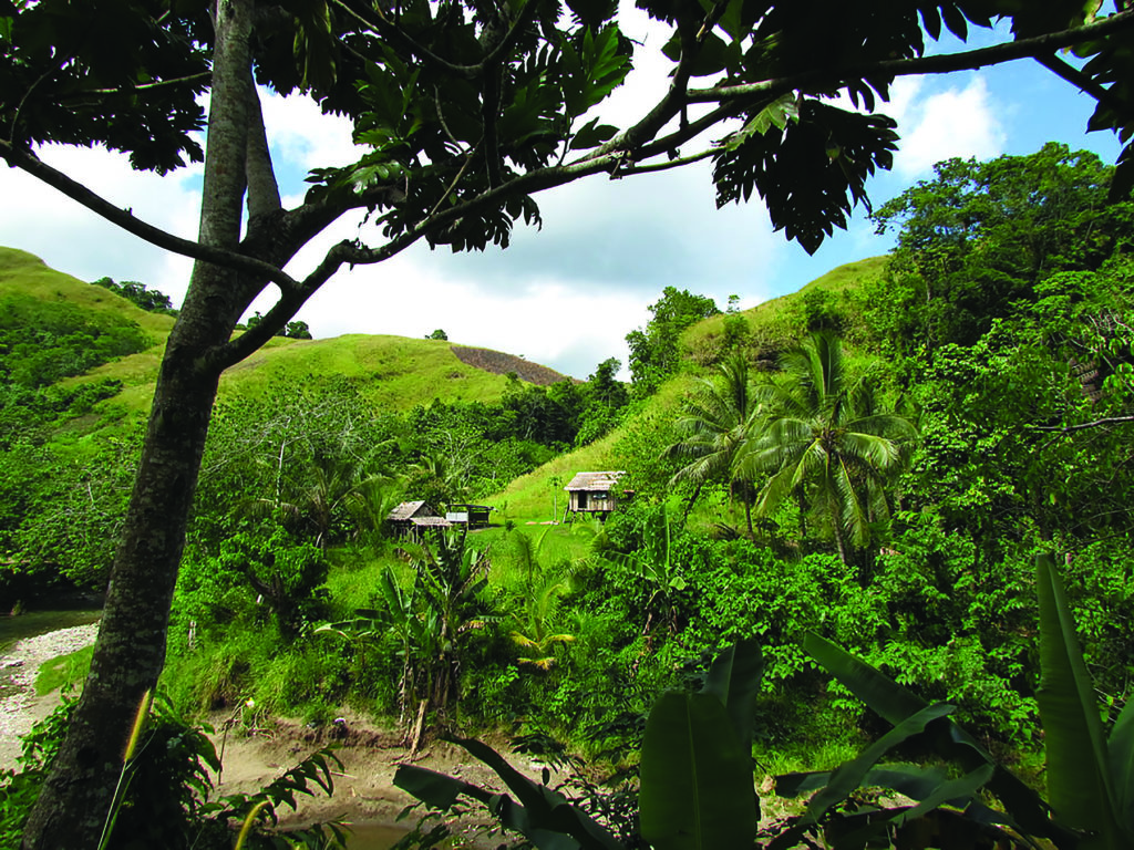
Since World War II, the capital city of Honiara has grown along Guadalcanal’s north coast: from Henderson Field, as U.S. soldiers renamed the airfield, to suburban Point Cruz. Galloping Horse Ridge runs east to west just south of its outskirts. The “ridge” is actually a series of steep hills and ravines that, when viewed on a map, appeared to a creative U.S. military planner to resemble a running horse. The hills are today mostly treeless and covered with tall green grasses and occasional rock outcroppings, much as they appeared in photographs taken during the campaign. They are populated, as our group found, by snakes and mosquitos, and are still pockmarked with trenches, foxholes, spent cartridges, and shell holes.
Paralleling the ridge to the south in a deep cut is the southwest fork of the Matanikau River. The river played a central role in the fighting for the island. In the battle for Galloping Horse Ridge, American troops ferried supplies up the navigable portions of this waterway.
The U.S. Army’s January 1943 plan to take this high ground involved infantry attacks by Major General J. Lawton Collins’s 25th Infantry Division, uphill against the entrenched Japanese positions. The 35th Regiment attacked southeast to the Gifu and Mount Austen. The 27th Regiment charged west up Galloping Horse Ridge’s “forelegs” and “hind legs.” Its 1st Battalion moved against the ridge from the north, while the 3rd Battalion attacked from the east. The deep nearby forks of the Matanikau River precluded flanking attacks from either the west or south.
The key Japanese position was Hill 53, on the “head” of the horse. The exhausted 3rd Battalion got stuck in a ravine just east of this hill, so General Collins ordered the reserve 2nd Battalion to pass through and continue the attack. That was when the battalion’s executive officer, Captain Charles W. Davis, famously led four men up the ravine to the fortified knoll at the south end of the hill. Davis tossed several grenades into the redoubt and ultimately destroyed the Japanese position. General Collins and other GIs viewed these heroics from below, which gained Davis the Medal of Honor.
To the east the 35th Regiment captured the Gifu and Mount Austen after heavy fighting. The mountains of Guadalcanal had been cleared. Some 200 Japanese fled down the cliff to Matanikau Falls, where they hid in caves behind the waterfall. In February all remaining Japanese troops evacuated the island in defeat.
On a hot, sunny day more than 75 years later, local guides led my traveling companions and me up and across the length of Galloping Horse Ridge and then back down on inner tubes along the adjacent Matanikau River past Matanikau Falls. We should have been wary when the agent told us that “no one has ever taken this tour!”
A modern white van picked us up at the Point Cruz Yacht Club. We drove south through mostly gridlocked Honiara traffic to the town of Tuvaruhu, and were finally dropped off at the tiny riverside village of Lelei. Two young men—Glen and Sander—and their dog met us here. They wore simple T-shirts and shorts. They were barefoot and carried no water, sunscreen, hats, or sunglasses. They were toting fully inflated inner tubes for our return down the Matanikau. How they and their dog would get back was left unsaid.
We forded the Matanikau just south of the village. The narrow dirt path immediately wound steeply uphill, shadeless in the 104-degree heat. We zigzagged up to the first rise on the 482-foot-long ridge. Ahead was a seemingly endless series of green hills and ravines, marked only by fading jeep trails. Soon, fatigue and sweat consumed us. As we ascended, we reached the route over which the 3rd Battalion had traversed as they attacked westward along the ridge. It was easy to see that the Japanese entrenched above would have had a clear view of the GIs. Even the interceding ravines offered no shade and no cover.
I casually remarked that there must still be bullets and shrapnel around. At this, Glen halted, strode a few steps off the path, and started digging into the dirt with his hand. Within a minute he came up with two shell casings. We kept on hiking, stopping only for swigs of water and to dig up more munitions. I thought about all the brave, scared young men who had climbed these hills, in stifling heat and under fire, and wondered for how many this magnificent view was their very last sight on earth.

Glen pointed out that we were approaching Hill 53—the site of the topmost Japanese fortification. It was now just a large green hillock. In the ravine below the hill I realized that we were at the location of Captain Davis’s stirring Medal of Honor charge. What motivates such men? After two hours of difficult hiking, a part of each of us wanted to quit and walk back down to Lelei village. The GIs, of course, didn’t have that option.
At the crest of Hill 53 we rested. It appears to have been landscaped; there was no overt evidence of a mighty Japanese redoubt. A modest home lay just below the hill to the north, and a woman and several children near it watched us on the summit. Just past the crest, someone had installed benches and trees, and it was refreshing to finally sit and rest in shade. But not for long. The woman below stormed up the hill from her house, screaming at us in a local language and gesturing wildly. Glen exchanged words with her, but she was not mollified. We apologized and moved on. I guess we were the first Americans to retreat from Hill 53!
From there, the trek down to the southwest fork of the Matanikau River confirmed that the hill could not have been flanked from the west. The path is steep and then gets steeper. The “trail” was pure mud, and we quickly fell into the classic hiker’s five-point stance, sitting and essentially sliding down the descent a few feet at a time. At least it was cooler.

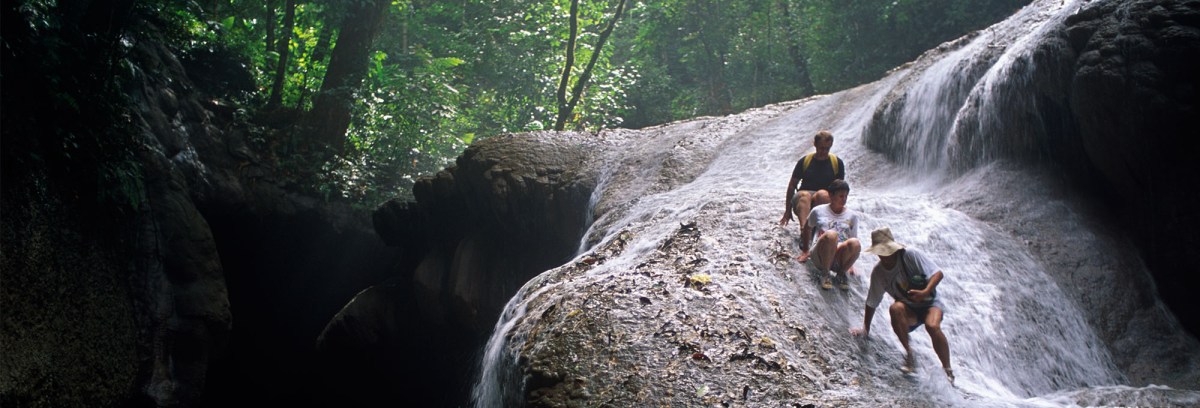
Finally, we reached Matanikau Falls, where GIs frolicked in the battle’s aftermath. Glen and Sander had carried our inner tubes all this way, so we were able to float and paddle behind the falls through one of the caves. Our movement from the falls to the river below required a careful descent down steep, wet rocks, using only footholds drilled into the granite by American troops. Once down we could continue on in our tubes. The amazing Glen, Sander, and their dog alternately waded and swam alongside of us. At shallow spots in the Matanikau we had to walk.
By now we were fatigued and soaking wet. As we approached Lelei, we fully appreciated how the difficult terrain had dominated the strategy and limited the options for taking Galloping Horse Ridge. Walking over a battlefield brings home the hardships and the tactical problems the soldiers faced. A book, a museum, or even a veteran’s personal account cannot provide that level of reality. Galloping Horse Ridge is difficult to negotiate and rarely visited, but offers a window on the horrific struggle that occurred there so many long years ago. ✯
WHEN YOU GO
The best way for Americans to get to Guadalcanal is via Nadi, Fiji, which welcomes nonstop 12-hour flights from Los Angeles. Pass the time by reading James Jones’s The Thin Red Line; it depicts in compelling fiction the assault on Galloping Horse Ridge. Battlefield tours can be booked through agencies like Destsolo Travel & Tours. The hike up Galloping Horse Ridge and down to the Matanikau River via the falls is strenuous, so participants must be in good physical condition.
WHERE TO STAY AND EAT
Stay at the Solomon Kitano Mendana Hotel in downtown Honiara. There is sublime fresh seafood everywhere on the island.
WHAT ELSE TO SEE AND DO
There are hundreds of sunken warships and planes to draw divers to the waters of Ironbottom Sound, off Guadalcanal’s north coast. The Solomon Islands have many other interesting sites that are best accessible by boat: on New Georgia Island wartime airstrips are still in use at the Munda and Seghe settlements, and there’s world-class snorkeling off the north coast. Gizo Island has a fascinating public market; nearby Kennedy Island was where the future U.S. president was marooned; and Pavuvu Island once hosted a huge U.S. Marine base. And if you get the local chief’s permission first, you can visit Skull Island off Vonavona and view the skulls of former chiefs and handle those of their vanquished enemies. ✯
This story was originally published in the June 2019 issue of World War II magazine. Subscribe here.