Past seems present in Peleliu, one of the Palau islands, where American and Japanese forces clashed in a bloody fight on a picturesque landscape

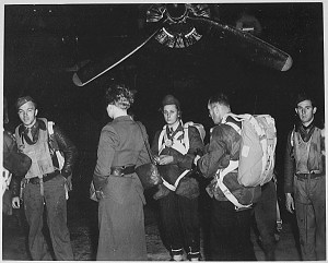
PELELIU, A FIVE-SQUARE-MILE ISLAND 500 miles east of the Philippines, seemed so strategically unnecessary to Admiral William F. Halsey, naval commander of the South Pacific, that in September 1944 he advocated bypassing it. The Japanese had an airfield there, though; American theater commanders thought U.S. Marines could quickly take the island, and overruled Halsey. On September 15, 1944, the 1st Marine Division landed 16,000 men on Peleliu’s southwestern coast. The division’s commander, Major General William H. Rupertus, told his superiors the operation would be “over in four days, maybe three.” He was wrong.
Today, this remote island offers little in the way of tourism and receives few visitors. It is not easy to reach: my family and I spent 24 hours flying between Chicago and the city of Koror in Palau, followed by a two-hour speedboat ride to Peleliu to tour its battle sites.
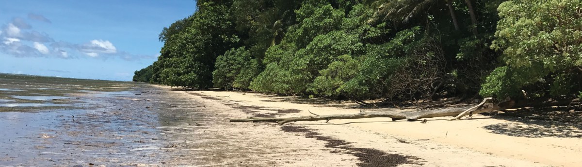
Shaped like a lobster claw, the island is a tropical green paradise—a mangrove swamp lies to the east and jagged Umurbrogol Mountain spines its western half. There has been little development in Peleliu since the war and only about 600 people live here. Most of the island’s battle sites are relatively untouched. When we arrive, we quickly feel transported back to 1944.
The U.S. invasion of Peleliu was to follow the common script for an amphibious landing. First, General Rupertus planned for a preinvasion air and naval bombardment of key Japanese positions. Then Marines in amphibious armored vehicles called Amtracs were to surge over the encircling reef onto beaches on the island’s southwest side to take on Japanese defenses. Next, they would charge inland to capture the airfield on Peleliu’s southern end. Finally, the men would attack north up the mountainous spine of the island to reduce the remainder of the Japanese garrison to dust. These strategies had worked in earlier landings during the war—but not this time.
During the preinvasion bombardment in early September 1944, 11,000 Japanese troops of the 14th Division hunkered down in the many natural and manmade caves they had prepared throughout Umurbrogol. On September 15, when the Marines hit Orange Beach, just southwest of the airfield, Japanese artillery and machine-gun fire from these ridges pierced armor and men. As the enemy attacked from the caves, the Marines saw no one to shoot back at. Nor did they have anywhere to hide; they could not dig foxholes in the hard coral. Surviving Marines swept across the airfield, but soon encountered a tank attack—rare in the Pacific—from the north. American Shermans eventually destroyed the Japanese tanks, but the toll was heavy. By the end of the first day, Marine casualties totaled 200 dead and 900 wounded. Day three was even worse, as the Marines tried to launch an attack up the mountain. The battle’s climax bogged down into such a horrific slog of killing there Marines dubbed the area “Bloody Nose Ridge.”

General Rupertus’s “three days” soon became more than two months of some of the worst combat Americans troops experienced during the war, resulting in the highest casualties for an amphibious landing in American history. By November 27, 1944, when the island was finally declared secure, the Marines and their U.S. Army 81st Infantry Division replacements had suffered more than 10,000 casualties out of a force of 28,000, including more than 2,000 deaths. All but a handful of some 11,000 Japanese perished. Yet after all that sacrifice, the island and its airstrip would play only a minor role in the conquest of the Pacific.
Seventy-four years later, this sleeping battlefield awakens to a quite different American force. As our group travels through the north end of Peleliu on a torrid October day—the same season as the battle—our local guide, Des Matsutaro, carries our backpacks, dispenses water, and packs us into an air-conditioned van.
The landing beaches are surprisingly narrow. Seashells and shrapnel litter Orange Beach, where the Marines first came ashore. The encircling reef is visible a few hundred yards away and leafy palm trees and bushes run all the way east to the airfield. Period photos Des shows us reveal that all this greenery had been blasted away, with tree stumps and coral dotting the landscape.
Des then drives us to the coral-mottled airfield that today looks more like a pothole-filled road. Most of the runways are overgrown, but one strip is still in use by a local Cessna charter service. Just north of the airstrip, wrecked armored vehicles rust in the fields where the tank battle had taken place. One tank lies heavily damaged from a huge shell that had ripped through it—not a good sign for its crew. I ponder who those young men were and think of the sad telegrams their families must have received.
On the edge of the airfield much of the elaborate two-story Japanese headquarters still stands. The concrete structure took a direct hit during Rupertus’s preinvasion shelling and its roof caved in. The columns and windows are long gone, but tilework remains along sections of the ceiling. Nearby, a bomb-scarred Japanese fuel storage bunker serves as a modest war museum. Inside, artifacts, photos, maps, and battle relics illuminate the Pacific Campaign. Farther north, a stone obelisk from 1944 marks the site of the temporary graveyard for American troops, with red bushes planted after the war spelling out “USA.”
Des next drives us to the east side of Bloody Nose Ridge for a hike to the top. A sign along the trail reminds us to stay vigilant, as “the area has not been cleared of Explosive Remnants of War.” Before long, we come upon a group of bombs carefully laid to the side of our path; they look live to me. Marching past an unidentifiable plane wreck, we find our first cave. Barely visible, a Japanese cannon on a sturdy metal frame faces toward where Americans would have been advancing. Cartridges, rifle parts, and rusty knives litter the path. (Visitors are strictly forbidden from removing war relics.)
As we hike upward, fatigue and sweat envelope us. With temperatures reaching 100 degrees, the bright sun cuts like a scythe. When the fighting began, American forces were clad in heavy dungarees and carrying packs and weapons; they were likely exhausted, filthy, scared, hungry, thirsty, sick, and mentally shocked by what they had seen and done. I wonder how they had advanced up this mountain while under constant fire.

A wooden stairway takes us the final 200 feet to the summit. The view west toward the ocean is breathtakingly beautiful. During the battle, the Japanese looked down from here on incoming Amtracs. Siting their artillery from this spot, they could hardly have missed. I take a deep breath. The scent of the ocean and the tropical greenery is a welcome break. I think about how the men confronted dramatically different odors in 1944. As Peleliu veteran E. B. Sledge wrote in his famed 1981 account of the battle, With the Old Breed: At Peleliu and Okinawa, nauseating smells infected the island: burning flesh, chemicals, exploding shells, diesel fuel, and even human excrement. “I felt as though my lungs would never be cleansed of all those foul vapors,” he wrote. Even breathing was a trial for these Marines.
Peleliu is often referred to as the “Forgotten Battle,” but for visitors, its isolation has made remembrances of the fight all the richer. The island remains a vivid memorial to the hardships and suffering the brave Marines and GIs endured here in 1944. I am now even more in awe of these men.
Peleliu is at the southern end of the Republic of Palau, about 500 miles east of Mindanao, Philippines. There are no direct flights; visitors will have to fly into Koror, Palau, and take a boat from there. There is a slow public ferry several days a week, but the best way to travel to Peleliu is to book a guided tour and take a speedboat ride. Contact your hotel or Peleliu Adventures (peleliuadventures.com). Shorts and t-shirts are not recommended due to searing sun, insects, and sharp foliage and coral. Bring lots of bottled water.
WHERE TO STAY AND EAT
Peleliu has a single hotel—the small, spartan The Adventures Inn (peleliuadventures.com), with four rooms. The hotel has Wi-Fi access and a modest café; there are no other restaurants. The inn’s staff will arrange free pickup from the airport for guests and organize tours and seagoing activities. Most accommodations and restaurants can be found on nearby Palau; local fare consists mainly of freshly caught seafood. Near Koror Airport is the luxurious Palau Royal Resort (palau-royal-resort.com), which features a spa and an outdoor dining and bar area overlooking the sea.
WHAT ELSE TO SEE AND DO
Palau is famed as a destination for diving and snorkeling along its reefs. Take a swim around Palau’s Rock Islands, limestone and coral formations in a turquoise sea that are one of the most beautiful sights in the world.