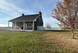
One cool, sunny day last September, I leaned against the stone wall that runs along the sunken road on Marye’s Heights at Fredericksburg, Virginia, and looked out over the ground that slopes down to the Rappahannock River. I was standing where Confederates of General Robert E. Lee’s Army of Northern Virginia stood on December 13, 1862, as they watched one brigade after another of the Union Army of the Potomac rush toward them uphill, only to fall in a hail of Confederate lead.
I could see how hopeless the Union soldiers’ mission was, and, how painful it became for the Rebels to see yet another brigade surge forward to be slaughtered. I could see, too, how precious even the tiniest outcropping or dip in the ground could be to a soldier under fire, how it could make the difference between life and death.
Seeing makes all the difference when you’re trying to understand the battles of the Civil War. You can read about Stonewall Jackson’s capture of Harpers Ferry before the Battle of Antietam in September 1862, and how he captured 12,000 Yankees–the largest surrender of American troops until the surrender at Bataan in World War II. But when you stand on the heights overlooking the town, you see that Harpers Ferry is in a bowl surrounded by mountains from which enemies can pour down artillery fire. You see how defenseless the town is, and you understand why Jackson was able to capture so many men with so little effort.
My visits to Fredericksburg and Harpers Ferry came during a nine-day tour that also took me to the battlefields of Second Manassas, Chancellorsville, Spotsylvania Court House, the Wilderness, Antietam, and Gettysburg. Throughout the tour, I enjoyed walking over the battlefields in the company of friendly, knowledgeable fellow tourists, and with the best possible guides–historians who knew every detail of the battles, and were able to communicate those details in the form of a good story. Time and again, these historians showed us things that could never be communicated in writing. Wil Greene, for instance, showed us the route Stonewall Jackson’s men used during their famous march around the Army of the Potomac’s right flank at Chancellorsville on May 2, 1863. Much of it, though called a “road,” was a rocky trail winding over heavily wooded hills, and barely wide enough for four men to walk abreast. For me, Jackson’s ability to move 26,000 men that far (14 miles) that fast (in one day), and then to crumple the Union flank, suddenly appeared as the superhuman feat it really was.
Throughout my travels, however, one thing kept coming to mind as a sort of underlying theme, namely that the understanding I was gaining by seeing the historic ground was possible only because that ground had been preserved. Meanwhile, Fredericksburg, where I learned so much by seeing the view from Marye’s Heights, is surrounded by some of the most intense development I have ever seen, and none of the Virginia battlefields I visited are more than a few minutes away from ever-expanding strip malls and residential developments, many with names like “Lee Heights,” or “Confederate Terrace.” One of our guides quipped, “In Virginia, we build roads through our Civil War sites and then name them after Civil War leaders.”
Let me suggest, then, that you try to visit a Civil War site this year in the company of a knowledgeable guide, and walk the historic ground. When you get home, you’ll have an appreciation of that ground, and you’ll be sure to support the organizations that help preserve it.
Jim Kushlan, Editor, Civil War Times
Originally published in the February 1997 issue of Civil War Times.


