A brace of massive topographical maps of the Civil War’s pivotal July 1-3, 1863, Battle of Gettysburg—though one is over six times the size of the other—have entertained, inspired, and educated generations of visitors to Gettysburg National Military Park.
The unique, one-of-a-kind maps have also helped park rangers, guides, and military officers study, explain, and interpret the tactics of the bloodiest battle fought on American soil.
The Famous Electric Map
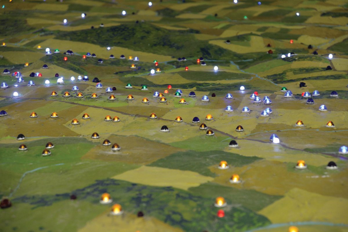
The best known of these—although not the oldest by far—is the 27×27-foot Electric Map, started by the Rosensteel family, which owned the largest collection of Gettysburg artifacts and operated for more than 50 years the most prominent private museum in town.
The route toward the family’s prominence as collectors and the creation of the Electric Map started a few days after the battle, when 12-year-old John Rosensteel came up from the cellar where he had taken shelter during the raging battle and began to help with the sickening chore of burying the dead. Like many other residents, he began picking up the things left behind on the battlefield, starting on July 5, 1863, when he removed a sharpshooter’s rifle from the grip of a dead Confederate soldier near Spangler’s Spring. That one item grew into the largest collection of Gettysburg items in existence, which now forms the core of the GNMP’s collection of 43,000 Civil War artifacts.
John’s nephew, George Rosensteel, started his own artifacts collection and by 1921 had enough to open a small museum. But both the collection and the Rosensteel property on Taneytown Road grew as George continued buying land—and more artifacts. His collection grew to epic proportions in 1927, when he inherited his Uncle John’s own collection and ultimately John’s Round Top Museum in his building on Taneytown Road.
It was George’s son, Joseph, who had the idea for the Electric Map. Always fascinated with maps, when he returned from college he conceived of using lights to illustrate battlefield action locations accompanied by a narration of the battle’s flow.
The first Electric Map debuted in 1939, and the existing larger version replaced it in a then-new 500-seat theater in 1963. In 1964, the Gettysburg Times described the new map. “Young Rosensteel has perfected a system of lights … whereby an electrical pageant of the battle is shown every thirty minutes. There are 314 lights on the map, 175 switches controlling them. Two miles of wire was used in making the connections.”

Concerned about the possibility of a buyer redeveloping the site, the Rosensteel family sold the museum and nearly seven acres of land to the National Park Service in August 1971 for $2.35 million. At the time, it was the largest land purchase ever by the GNMP and the first purchase nationally that included a transfer of a copyright. It was reported then that the museum and the Electric Map were attracting more than 500,000 visitors a year.
During the height of the family vacation era, from the 1950s through perhaps the early 1980s, the Electric Map was the essential first stop at Gettysburg, and even today it represents the most vivid memory of youthful visits to Gettysburg for millions of Boomers. No other attraction—not the wax museums, the Charlie Weaver Museum, not Fort Defiance or Fantasyland, not the miniature golf or the National Tower—ignited the loyalty and nostalgia of the Electric Map.
Ike and Monty Pay A Visit
Over the years, the 22 to 30-minute performances probably did more to create the public story of Gettysburg than any other single resource. The narrator read the script—later recorded—and flicked the appropriate lights to show the location and movements being discussed. For example, when the narrator stated that Confederate Lieutenant General James Longstreet’s troops moved forward into the Devil’s Den/Little Round Top area, a series of lights traced that movement.
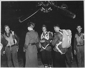
Word about the Electric Map spread widely. Among the frequent visitors was Gettysburg’s best-known resident, Dwight D. Eisenhower. The local newspaper reported on May 11, 1957, that then-president Eisenhower had started a daylong tour of the battlefield for World War II colleague Field Marshal Bernard Law Montgomery, 1st Viscount of Alamein, deputy NATO commander, with a stop at the Electric Map.
The paper reported that the two watched Mr. Rosensteel’s program intently, occasionally whispering comments to each other. Leaving the map, Montgomery remarked that if he were in charge, he would have sacked both [Union commander George G.] Meade and [Confederate commander Robert E.] Lee for the way they fought the battle. Asked his opinion by accompanying reporters, Ike quipped, “If you had fought the way Lee did, I’d have sacked you myself.”

The Electric Map was also used as a training tool for military officers, including students from the nearby Army War College in Carlisle. A newspaper article from 1964 noted, “That knowledge … made [Joseph Rosensteel] a lecturer in demand, using the map, for Army officers. Yearly, numerous officers, many from foreign countries, come here to hear Rosensteel give details of the battle on the map. By using different combinations of lights he can give a four hour or longer lecture getting down to such fine details as maneuvers of regiments.”
The Electric “Nap”?
The Electric Map was rejected for a place in the new visitor center, which opened in 2008. Visitation had slipped and it was considered outmoded. Park Superintendent John Latschar was frequently quoted referring to it as “The Electric Nap.”
The park repeatedly said the map would be replaced with a higher tech, more modern presentation, but in the end it was replaced with…nothing.
But the Park yielded to the public outcry—and the public comments by the Rosensteel family urging the park to turn the map over to a “proper nonprofit organization”—and at last agreed to auction the Electric Map off rather than send it to a landfill. Two bidders materialized at the 2012 auction, and Hanover businessman Scott Roland won with a bid of $14,000. Roland hoped the map could help attract tourist and conference business to Hanover, which is 12 miles east of Gettysburg and the site of a June 30, 1863, cavalry battle.
Then came the hard part—transporting four 5-ton, 27×7-foot pieces to Hanover, lifting them with a crane through a second story window, and then the exacting work of restoring the map—running seven miles of wires, replacing hundreds of light bulbs—before regenerating the program and the lighting cues with little or no documentation.
The map was opened (briefly) in 2016 before being closed for safety and Americans with Disabilities Act access issues and is now open on an appointment-only basis.
The Cope Map
The smaller topographical map, known as the Cope Map, is even older than the first (1939) Electric Map. It was created in 1904 as a U.S. War Department exhibit for the St. Louis World’s Fair and was then brought back to Gettysburg. A newspaper article described the map as “an accurate representation of the topography of the field, with all the existing buildings, avenues, and roads, on a horizontal scale of 200 feet to the inch and a vertical scale of 72 feet to the inch, and embracing an area of 21.15 square miles. The map is … 9 feet 3 inches in width and 12 feet 8 inches in length.”

The map was built in layers, with the topographical map laid out and then successive 1/6-inch layers of white pine strips, each layer representing 12 vertical feet, with the contours of the land cut out and pegged together “until every hill, ridge, and the entire surface is built up and shown in successive terraces of wood.” The precision of the map was described in a newspaper article: “… the division of the land into fields appears, what kind of fence, whether post or rail, tapeworm or stone, is made plain on the map; so much of the ground as is covered with brush or timber is made plain. The farm buildings are all accurately located … Any building can be instantly recognized.” In a 2021 lecture on the map, ranger Troy Harman agreed, noting, “I can’t emphasize enough how precise it is. This matches up with the land in ways no other map I’ve ever seen. Areas that were altered by development—if you want to see what they looked like [before the development], come back and look at this map.”
For about a half-century, the map was in the GNMP offices on the second floor of the Federal Building (now the Library), then was moved in 1963 to the Cyclorama Center, where it lay flat in the second story lobby before making the move to its present home in the new park Visitor Center.
The Cope Map never had the public exposure of the Electric Map, and until the move to the new Visitor Center was primarily used by rangers, licensed guides, and other specialists. Frederick Tilberg was hired in 1937 as the park’s first historian, working there until his retirement in 1965. He wrote a 16-page guidebook for the average visitor, started the park’s summer campfire program, and created the first auto tour route.
The buildings now known as the West End Guide Station and the South End Guide Station were the primary visitor reception facilities until the modernist Cyclorama Building opened in 1963, but some visitors stopped at Park Headquarters in the old post office building, and those who visited could receive an orientation lecture from Tilberg or another park ranger at the relief map. Until the opening of the Cyclorama building, most visitors’ only contact with an interpretive ranger was at the relief map at the old Post Office building where they received an orientation lecture.
Making Gettysburg “Click” For visitors
Ranger Troy Harman agrees that the map is useful for understanding the battlefield and the combat that took place. “I’ve had the good fortune to do many battle walks. I can’t tell you how many times I was stuck in the old Cyclorama building in the winter. I couldn’t get out and study for the summer program that I had. I would walk out in the lobby and study this map. It was so precise; it would help us prepare over and over again.”
The Cope Map did make the cut to come over to the new visitor center. In its current location near the museum exit, the map is frequently mistaken by visitors for the Electric Map. Many people standing by the map have misremembered, their fading memories prompting comments such as, “I remember seeing this when I was a kid, but back then it had lights and they did a little show.”
And it is still used to provide orientations for visiting groups from the Army War College and other U.S. and international military units.
Ken Rodriguez, a retired officer who brings groups of special operations soldiers to Gettysburg, described the importance of studying a topographical map. “There’s nothing quite like an accurate and realistic map to assist the warrior-leader in understanding the battlespace …. A good map can identify hazards, obstacles, routes of march, ambush sites, rally points, and advantageous high ground. Good maps are also essential for training and education. I would never have understood the Battle of Gettysburg without … the large relief map at the Visitor Center. Though we had been studying the battle for two days, the map made it ‘click’ for many of my team, especially when we were drawn into the distances, orientations, terrain, structures, and relief of the battlefield.”