The World War I Western Front spanned some 330 miles as the crow flies, from Nieuport on the Belgian coast southeast to the Swiss border. Less than a mile from the Alsatian village of Pfetterhause is the southern anchor point, known then and now as Kilometer Zero, which remained fixed from late August 1914 through war’s end. Marking the spot is a four-sided stone post dating from 1743—Swiss frontier marker No. 111. During the war no-man’s-land was the narrow Largue River, the Germans occupying the east bank, the French the west. To the south the Swiss army deployed observers to prevent either side from trying to outflank the other through their neutral territory.
Alsace is part of France today, but in 1914 it was a German territory. Since losing the region to Germany under the terms of the 1871 Treaty of Frankfurt, the French had placed its reacquisition high on their list of national priorities. Indeed, on Aug. 7, 1914, the First Army’s VII Corps under General Louis Bonneau launched France’s opening offensive by attacking into Alsace, headed for the Rhine River. The next day the French took Mulhouse, the largest city in the Sundgau region. But on August 9 the German Seventh Army under General Josias von Heeringen counterattacked and drove the French back almost to their line of departure.
Determined to retake Alsace, the French command sacked Bonneau, reinforced VII Corps and attacked east again on August 14. By the 19th its troops had retaken Mulhouse and all the ground south to the border. But setbacks elsewhere along the front soon forced the French to shift VII Corps north. On August 26 the unit withdrew from Mulhouse and most of the Sundgau, leaving only a covering force in western Alsace. While Germany redeployed most of its Seventh Army north, it left a robust force to cover from the west bank of the Rhine to the eastern face of the Vosges Mountains. On the Swiss border the French managed to retain Pfetterhause.
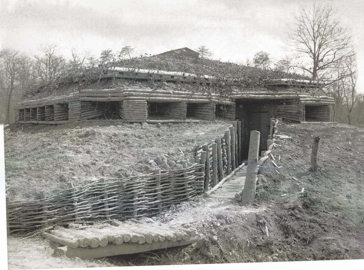
The combatants fought several major engagements in the Vosges, but for the duration of the war no further large-scale clashes broke out in Sundgau. The respective armies dug in, built reinforced concrete fortifications, then raided, shelled, bombed and sniped at each other. The Swiss, meanwhile, built a line of observation posts along the border. Not meant to be fighting positions, they were built of wood and earth. The main Swiss defensive line lay several thousand yards to the rear. Flouting the relatively flimsy border security measures, both French and German deserters slipped across into neutral Switzerland. Most would live to see home again. But by war’s end some 60,000 German and 59,000 French soldiers had been killed in Alsace, including those fighting in the Vosges. Their bodies rest in 34 German and 56 French military cemeteries.
Several years ago a local preservation group built a well-marked historical hiking trail anchored on Kilometer Zero. Several defensive positions have been partially restored. Shell craters and trench lines remain visible in spots, as do a few large aerial bomb craters. Designated stops feature interpretive signs in French, German and English, with maps and period photos.
Highlights include the ruins of the southernmost German position, a concrete machine gun outpost about 100 yards from the Swiss border. Set farther back, about 500 yards from Pfetterhause, the remarkably well-preserved Villa Agathe is the southernmost concrete bunker on what was the French side of no-man’s-land. Only a few feet south of the border sits Swiss army observation post No. 2. The present-day wooden blockhouse is a faithful reproduction built in 2013 by actual Swiss army engineers. Directly in front of it is the venerable old Kilometer Zero marker, where it stood throughout the war and in the century of regional peace since.