
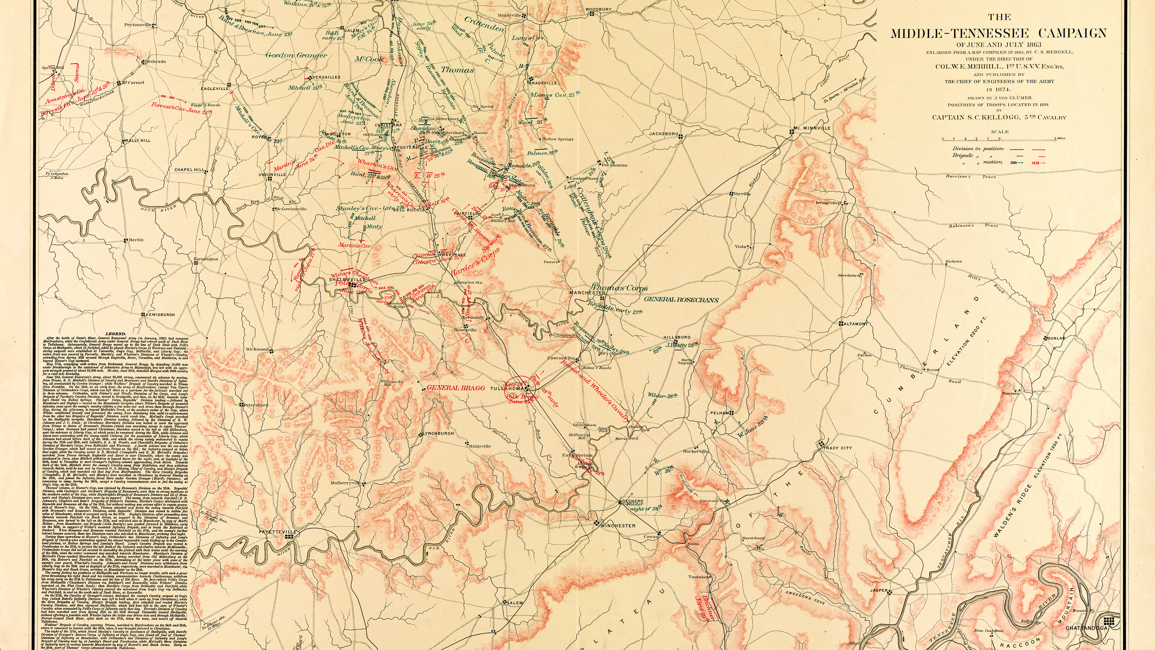
This map of Middle Tennessee is a prime example of the care and intricacy Merrill invested in each of his maps. Lead pencils were used for any data transferred from other maps; corrections were made only with colored pencils. (United States Corps of Engineers/Library of Congress)