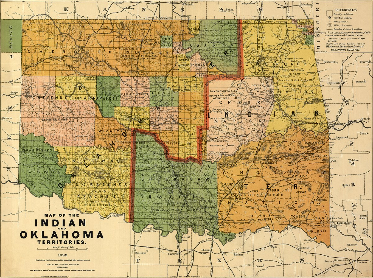

This 1892 map depicts the Oklahoma and Indian Territories not long after the famous Oklahoma Land Rush that started April 22, 1889, and eventually brought 50,000 White settlers into the area—a significant development in the establishment of the state of Oklahoma. Settlers who had slipped over the border before the rush’s official start date to claim land were called “Sooners.”
The eventual dissolution of c has a sad and complex history. The term originated in 1835 when Southeastern Indian tribes were forcibly displaced from their native lands and moved west of the Mississippi River, an event the Cherokee called the “Trail of Tears.”
Over the ensuing decades, through a number of federal acts and treaties, Indian Territory continued to shrink until it consisted of the area represented on this map. Through a number of congressional decrees—33 alone in 1870–79—White settlers were allowed to move in and take up residence in Indian Territory.
After the Land Rush, the Organic Act of 1890 created the new Oklahoma Territory boundary. Plains Tribes were placed on reservations in Oklahoma, while Indian Territory remained the home of southeastern tribes. The map includes the years the treaties were drafted giving the land to the respective tribes.
Eventually, both territories were merged into one, the Oklahoma Territory, and the term Indian Territory disappeared from federal lands. After four separate plans, the state of Oklahoma was created in 1907.
Despite the colorful, engrossing appearance of this map, it actually documents one of many steps in the marginalization of Native Americans in the United States.

this article first appeared in American history magazine
![]()
![]()