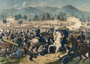
I grew up only 25 miles north of Gettysburg, and the battlefield has been a second home to me. In February 2012, I created a Facebook page, “Michael Waricher’s Gettysburg Perspectives” to share photography of the Gettysburg battlefield I had been collecting.
The period that most captivated me was the Commemorative Era, generally defined as 1864 through the battle’s 50th anniversary in 1913. During that time, veterans returned to visit with their families and for reunion encampments. Monument dedications were frequent, and a large portion of the battlefield infrastructure was built. The park was transitioning from the grassroots oversight of the Gettysburg Battlefield Memorial Association (1864-1895) to that of the federal government’s War Department (1895-1933).
Bringing Gettysburg photographs back to the light of day and endeavoring to share the stories they depict has been an enjoyable 11-year journey for me. The daily process of researching facts and details to accompany an image has made me a more thorough historian. As a result, the page has grown and become more engaging. I find it a unique means of perpetuating the memory of the battle’s veterans while also retelling the story of the battlefield itself and its builders.
This collection of images offers an appealing Commemorative Era sampling from a variety of locations. In some photographs, things appear starkly different, and in others they look quite similar to today. We are seeing the battlefield evolve through a half-century of intensive toil and expenditure.
The next time you’re on the battlefield, take a moment to look around you. That monument, cast iron sign, gun carriage, or the avenue on which you are driving were all products of the Commemorative Era at Gettysburg. It truly was a golden age for the park.
Devil’s Den
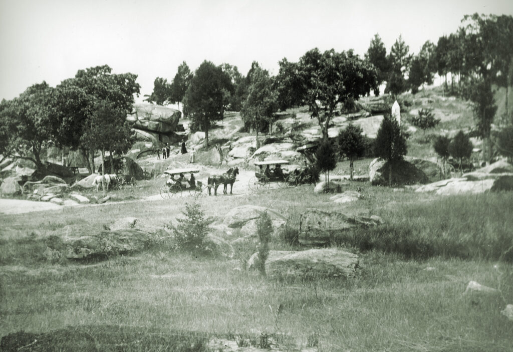
The curious, oversized jumble of boulders known as Devil’s Den was a popular destination for late 19th-century visitors and a lucrative spot for local photographers to ply their trade. Tourists found the opportunity to have a family photo taken in front of the massive formations tremendously appealing.
This circa 1895 photograph captures a typical summer’s day of the time. The camera gazes across a gently flowing Plum Run toward Devil’s Den’s northern approach. Neatly situated below the looming Round Tops, carriages deliver passengers for an afternoon of leisurely exploration. Here, stands of mature trees grow with random abandon among the diabase boulders while the grounds present a carefully maintained appearance. A worn network of footpaths and wagon traces pass through the rocks to various points of interest.
The precariously balanced “Table Rock” peeks from between the trees at the left-center portion of the image, its face marked by white chisel gouges resulting from recent efforts to remove years of accumulated graffiti. In the right-center of the photo, the white tip of the 4th Maine Infantry obelisk defies a tree’s best effort to obscure it. Survivors of the 4th Maine dedicated and presented the monument to the Gettysburg Battlefield Memorial Association on October 10, 1888.
154th New York Monument
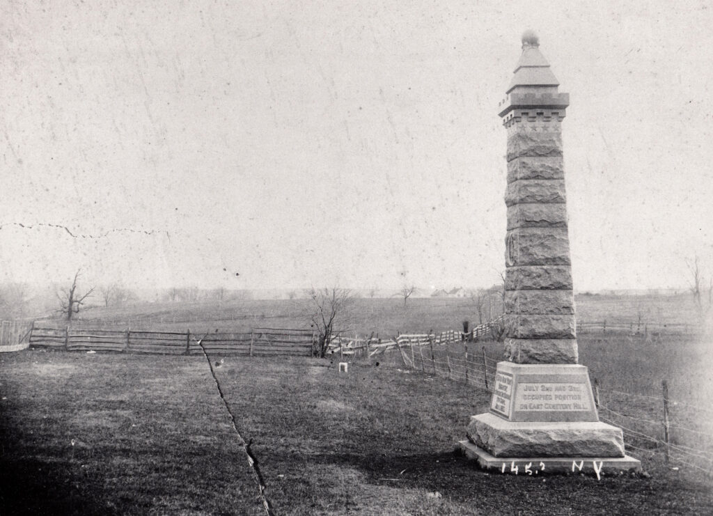
On July 1, 1890, the surviving members of the 154th New York Infantry gathered in a trimmed field east of North Stratton Street to dedicate a memorial to their actions 27 years prior. On this spot, as the 11th Corps lines crumbled to the north, they and their brigade comrades commanded by Colonel Charles Coster had courageously attempted to slow the enemy’s rush.
The 154th had numbered nearly 600 men before the Battle of Chancellorsville. As a testament to the severity of their actions in that battle, only 239 were present at Gettysburg. On July 1, 1863, they suffered 200 casualties, most captured while attempting to extricate themselves from the Confederate assault that afternoon.
By 1890, monuments were rapidly dotting the battlefield, and the avenues to carry visitors to those sites were either being planned or in the early construction stage. It was a high point of the Commemorative Era for the battle’s veterans. The Gettysburg Battlefield Memorial Association, the park’s oversight entity, had purchased a parcel of land on the outskirts of Gettysburg’s northern limits to further their work. Nearly the length of a football field and a mere 20 yards in width, Coster Avenue would provide the land for the brigade’s tributes.
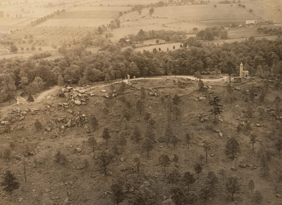
Stevens’ Knoll
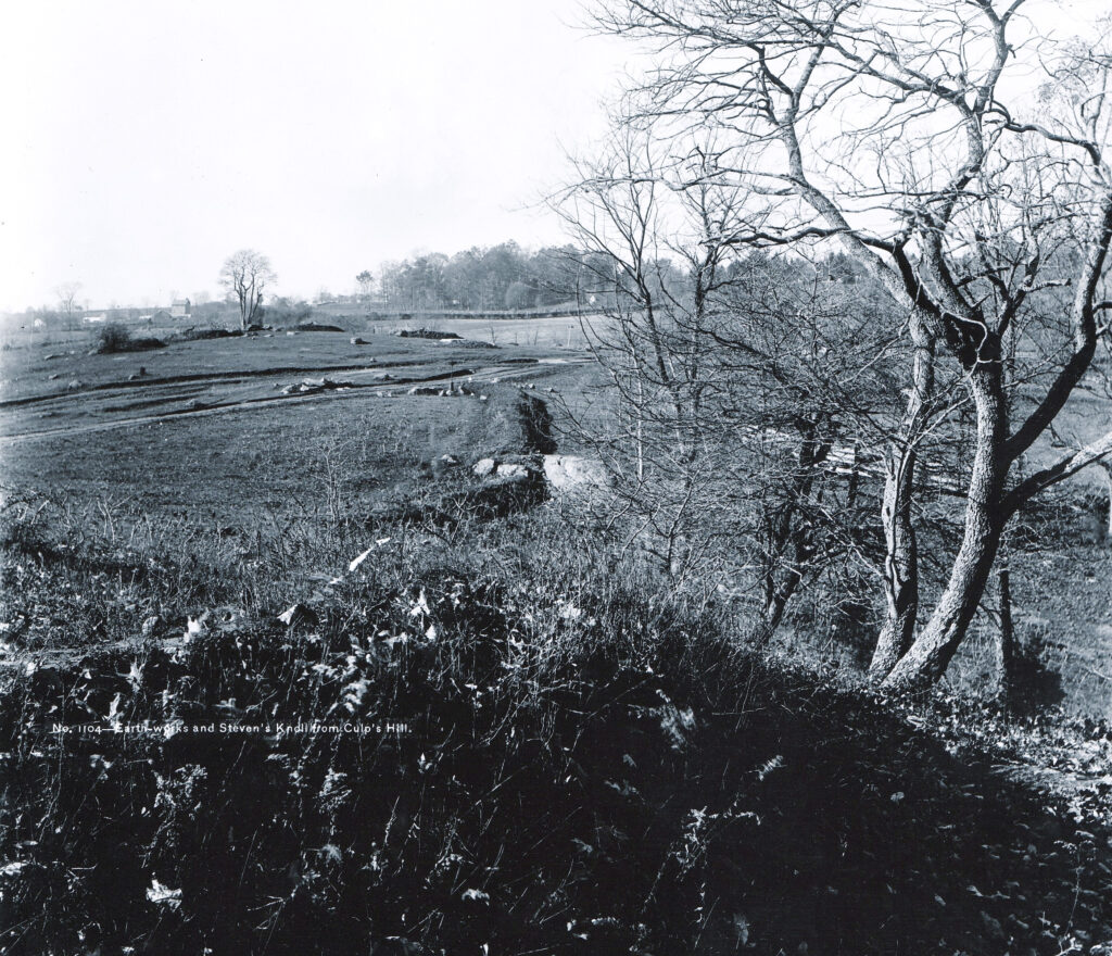
Photographer William H. Tipton meticulously documented the Gettysburg battlefield’s development. In 1888 or early 1889, he captured this view to the west while standing on Culp’s Hill’s northwest slope.
The most prominent features of Tipton’s image are the recently reconstructed earthworks of the Iron Brigade, running east to west through the center of the photograph toward Stevens’ Knoll. The earliest commemorative features on that hill are the artillery pieces of Captain Greenlief T. Stevens’ 5th Maine Battery. A closer inspection also reveals the finished base for that unit’s yet-to-be-completed monument. Major General Henry Slocum’s equestrian monument is still 13 years from its appearance on the hill.
This unique perspective yields a remarkable, richly detailed glimpse of Cemetery Ridge on the horizon. The conspicuous two-story house beyond the knoll is the Wright House (today’s park law enforcement office), and the white structures to its left are Lydia Leister’s house and barn—Maj. Gen. George Meade’s headquarters during the battle.
A striking aspect of this view is the open landscape, as a returning veteran would have witnessed during the battle’s 25th anniversary. In this instance, it’s a vista long lost to modern visitors through changing land use and management practices.
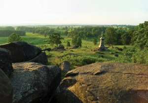
Little Round Top
The monument in this 1885 image was dedicated by 91st Pennsylvania veterans in 1883. Six years later, the monument moved onto a flat, etched stone dedicated to the memory of Brig. Gen. Stephen Weed and Lieutenant Charles E. Hazlett, both mortally wounded nearby. In 1889, the Pennsylvania veterans would erect an impressive 25-foot granite specimen at the site of the original.
In May 1885, the GBMA ordered 30 iron gun carriages from the Navy Department, at a cost of $20 per piece, like those seen here. Such carriages began to be phased out in the late 1880s when the park contracted with the local Gilbert & Smith Foundry for 30 more realistic iron models. Examples of these Gilbert & Smith carriages remain on the battlefield.
East Cemetery Hill
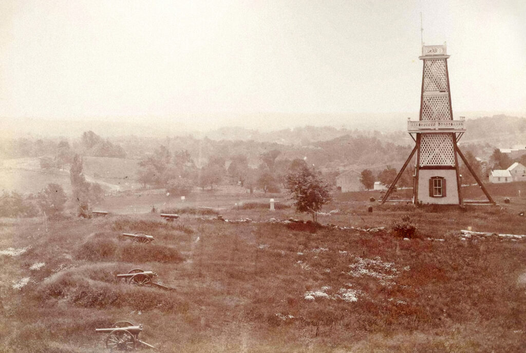
This early 1880s photograph depicts East Cemetery Hill and the guns of the New York and Pennsylvania batteries that had defended it. With the exception of the small, white marker at the center of the photo, East Cemetery Hill was relatively devoid of monumentation. The veterans of Battery B, 1st Pennsylvania Artillery (Cooper’s Battery), placed this marble-capped memorial in 1879. It was the first artillery marker on the battlefield.
The wooden observation tower was constructed in the spring of 1878. It stood 50 feet tall with viewing platforms at its midpoint and peak. The observatory would gradually deteriorate before being sold and dismantled in 1895. The Maj. Gen. Winfield Scott Hancock equestrian monument would stand on its footprint the following year.
Railroad Cut Bridge
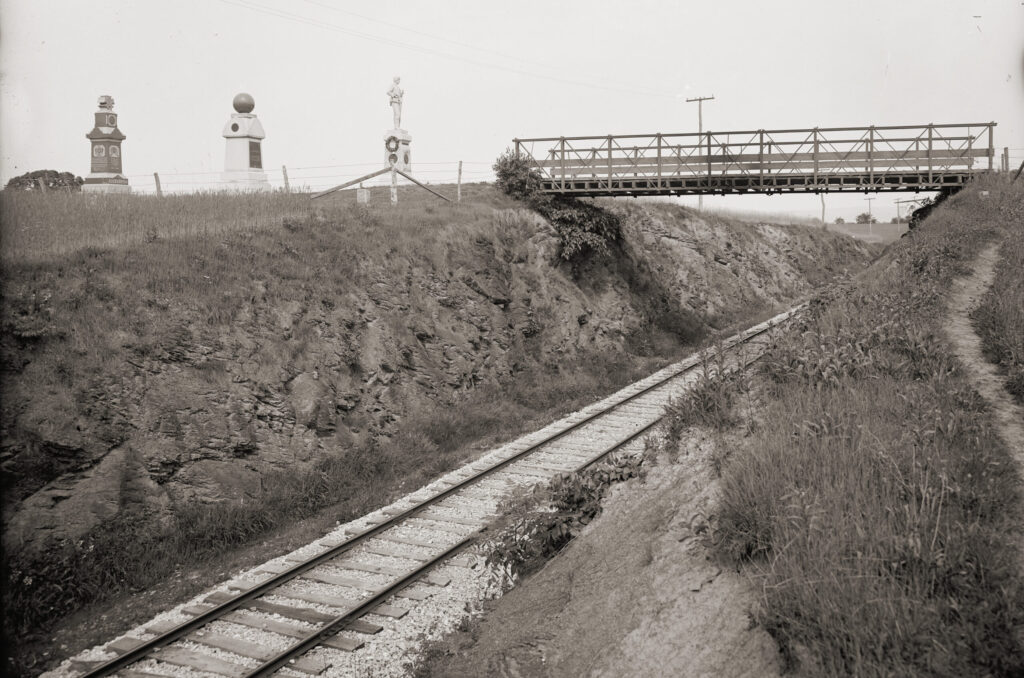
By the mid-1880s, the monumentation of the Gettysburg battlefield was burgeoning, and the Gettysburg Battlefield Memorial Association provided avenues to accommodate the growing visitation.
The ferocious fighting that had taken place on McPherson’s Ridge and the surrounding lands made it an attraction for both returning veterans and visitors to the battlefield.
At the request of the GBMA, historian John Bachelder conceived Reynolds Avenue, running along the spine of McPherson’s Ridge, in May 1885. Its eventual completion provided a main north-south artery for battlefield traffic between Hagerstown Road to the south and Buford and Wadsworth Avenues to the north. The only obstacle along this nearly mile-long straightaway was the second ridgeline cut of the Western Maryland Railroad. At 19 feet deep and with a span of roughly 50 feet, a bridge would be needed to facilitate a seamless traffic flow.
At a February 25, 1886, meeting of the GBMA’s Executive Committee, they agreed to contract with the Gettysburg foundry of Calvin Gilbert and Joseph Smith to construct the necessary bridge, a 14-foot wide, iron truss-style span with oak plank flooring for a sum of $635.
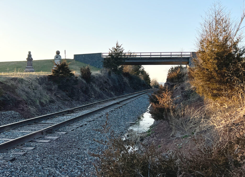
The Detroit Publishing Company photograph seen here dates to the early 1900s. The image looks from the northeast bank of the railroad cut to the west and captures the first of the four bridges that have spanned this gap between 1887 and 2023. The image also depicts the original depth of “the cut” and the 6th Wisconsin, 95th New York, and 14th Brooklyn monuments on its southern bank.
Wheatfield Trolley
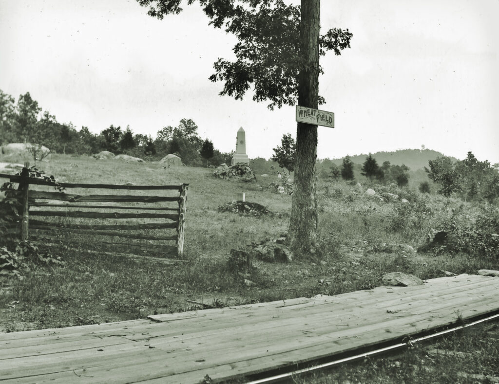
Gettysburg National Military Park has faced its share of challenges since its inception. Few would prove as controversial as the appearance of an electric railway on battlefield land in 1893.
Fully operational by May 1894, the eight-mile “trolley” circuit, which cost $170,000, emanated from the heart of Gettysburg and made seven stops while crossing over some of the most sacred lands of the second and third day’s battlefields.
Ohio photographer Albert Kern captured a portion of the “electric road” at the Wheatfield stop below The Loop in this late 19th-century image. Note the planking for passenger boarding and unboarding. From this point, the trolley continued southward to Devil’s Den and Little Round Top.
A groundswell of opposition to the trolley quickly arose, led by former Maj. Gen. Daniel E. Sickles, veterans, and popular newspapers. Harper’s Weekly led the charge, running an article, “The Gettysburg Desecration” in its July 1, 1893, edition. Lamented battlefield historian John Bachelder in the article: “The railway cuts straight through lines of battle, forest trees are levelled, boulders and ledges blasted…and the whole character of the field is changed.” Harper’s Weekly author John Reed Scott emphatically declared, “The trolley vandals have hewed their course of destruction, and all the pristine beauty is gone forever, the victim of corporate greed.”
But the trolley proved popular with tourists for a time. Ultimately, the rise of the automobile, improved park roads, and the general deterioration of the trolley infrastructure would drive the electric railway’s demise in 1916. Traces of the trolley route remain discernible on the battlefield today.
Michael J. Waricher, a Carlisle, Pa., native, is a professional artist and lifelong student of the Battle of Gettysburg. Through his Facebook page, “Michael Waricher’s Gettysburg Perspectives,” he shares his research of the battlefield’s history through photos.

this article first appeared in civil war times magazine
![]()
![]()