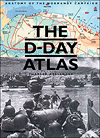
The D-Day Atlas: Anatomy of the Normandy Campaign, by Charles Messenger, Thames & Hudson, New York, 2014, $24.95
The 70th anniversary of D-Day is upon us, and here again is Charles Messenger’s D-Day Atlas, originally published for the 60th anniversary of the campaign and now reissued in paperback. So it should be for each landmark anniversary, for it is truly a handsome piece of work. The maps are large, clear and easy to read, and the text on the planning stages of the invasion is as absorbing as that on the thrusts and counterthrusts of combat. Succinctly covering the broad scope of the campaign, which began almost as soon as the British rescued their forces from Dunkirk in 1940, the 165-page resource has that rare quality of a great story compellingly told.
Messenger is a prolific military historian, having written more than a dozen books about World War II, key figures and the weapons used; illustrations in this edition include diagrams of tanks, machine guns and artillery pieces. He also knows his commanders, German and Allied; among the biographies he has written is one of Field Marshal Gerd von Rundstedt, who was in charge of the defensive forces in western France. Messenger has an eye for details, familiar and unfamiliar. It is well known, for example, that on the night of June 5, 1944, Adolf Hitler’s doctor had given him a drug to help him sleep, and the Führer could not be awakened to release German tanks in reserve, having previously ordered that only he could release them. Brig. Gen. Theodore Roosevelt Jr.’s heroism at Utah Beach is also well known, but few readers may be aware that sailors nicknamed early models of the LST (landing ship, tank), the vessel that transported Allied tanks, other vehicles and troops to shore, the “Large Slow Target,” with a top speed of 12 knots (14 mph).
It is the maps that really make this book, however, detailing where the airborne troops landed, how far Allied units penetrated day by day, where German resistance was particularly strong, and where attacks and counterattacks were successful or not. Vividly rendered, they clearly and comprehensively relate the progress of the Allied advance across France. Maps and text together make for a terrific introduction to this complex and exhaustively planned invasion, which likely will remain the largest amphibious operation in history.
—Anthony Brandt


