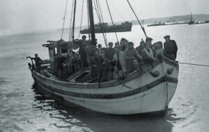
 When James P. Delgado became director of the Maritime Heritage Program at the U.S. National Oceanic and Atmospheric Administration (NOAA) in 2010, the agency’s Battle of the Atlantic Project was in its third year. The ambitious multiagency effort seeks to research, locate and document the many German U-boats, Allied warships and merchant marine vessels lost in the early 1940s along the mid-Atlantic coast. Delgado—a marine archaeologist, historian, museum director and author of 33 books—speaks often of his passion for the sea and for history. His is a unique perspective, as he has explored firsthand and written about a wide range of military shipwrecks: Kublai Khan’s 1281 invasion fleet at Takashima Island, Japan; the battleship USS Arizona at Pearl Harbor; the 1842 U.S. Navy brig Somers; the ships sunk during atomic testing at Bikini Atoll, including the aircraft carrier USS Saratoga, and many others.
Why is it important to preserve and document historic shipwrecks?
Shipwrecks represent largely untouched frozen moments in time.
When you’re diving on a site what is the first order of business?
We document everything without disturbing it. It’s just like walking around a crime scene—we tag and photograph everything but don’t pick up a single piece of evidence. Everything we can see is mapped, drawn, recorded and photographed.
‘With older wrecks, we can find crew possessions, things that they had with them that allow us to start putting a human face on the ship’
What was your most challenging dive?
The most difficult were the dives at Bikini Atoll. Once, I was about 150 feet down and got trapped within Saratoga when a portion of the wreck collapsed and sealed us inside.
How did you get out?
I had the divemaster from Bikini with me, and we’d laid a safety line, but it got buried. We had extra lights and some extra air, but not much. The overhead had collapsed, and we remembered that that overhead was the next deck, where there was another corridor. We went up into the other corridor and were able to make our way to where we could force a door open. We ended up exiting, fortunately, into an open shaft that was the bomb elevator.
How long did your escape take?
A lifetime.
What are your goals with the Battle of the Atlantic Project?
The idea is to do a comprehensive survey of a very important forgotten battlefield. Next year it will be 70 years since German U-boat packs came over to strike at shipping off America’s shores, in Operation Drumbeat. Between the beginning of 1942 and the end of August, 285 merchant ships [were] sunk. And seven U-boats are known to have been sunk off the Carolinas. It was a terrible assault, and we feel that the area off the North Carolina coast is as significant a battlefield for Americans as Gettysburg and, in some ways, as significant as Pearl Harbor.
Is there a comprehensive inventory of World War II wreck locations?
There are records, but they don’t always say exactly where something happened. The U.S. Merchant Marine had the highest rate of casualties of any [American] service in World War II: 1,554 ships were sunk due to war conditions, and 733 of them were over 1,000 gross tons, meaning they were big ships. Now we’re looking for one U-boat. Just by plotting reports from those who sank it, we have a search box in the ocean that spreads over many miles.
Without accurate records, how do you locate the wrecks?
First, we do the historical research. NOAA historian/archeologist John Wagner has been doing detailed research and plotting locations based on the historical records. That gives us basic zones in which to look.
How big is the typical search box?
We’re looking at large areas of the ocean. We “mow the lawn” over many square miles, using sophisticated electronics. High-resolution sonar allows us to map the seabed. We also have magnetometers that show where large concentrations of metal are. We have a highly trained dive team, and we have remotely operated vehicles that can go where people can’t safely go. So we survey, find a target and then “interrogate” that target—find out what it is, and then try to determine its identity.
“Mow the lawn”?
That’s a systematic survey with a variety of instruments that will tell us when we’ve just passed over a large anomaly [on the seafloor]. In some cases you can see the lines and masts, and you know you’ve got a ship of a certain vintage. Sonar these days will let you know if [the target] is a steel or wooden hull. You can see how long the ship is and how wide and how tall the mast is and how big hatches are.
We either tow [the sensor systems] behind the ship, or sometimes they’re hull-mounted. Or they’re mounted in autonomous underwater vehicles, AUVs—torpedo-shaped vehicles programmed to go out on their own and survey. We also have optical systems that take pictures constantly.
When would you use an AUV vs. an ROV?
We use the AUVs in deeper areas and when we’ve got a bigger area to cover. The ROV is a tethered robot we use when a diver can’t safely get to a site. We use the ROV to get a close-up look, and we’ll mount sonar on it, take pictures or video. In some cases we’ll mount tools on them, so we can take samples of fuel oil or see how the metal is corroding or even pick something up.
Are there World War II wreck sites people can visit now?
Yes, when NOAA goes in to research a site, it isn’t like putting up a fence [to protect the sunken vessels], it’s about finding, surveying, determining what’s there and, in some cases, solving mysteries. And it’s about giving families a sense of closure: [We can say,] “This is where your father, or uncle on grandfather lies.”
What kinds of historical information can a wreck—for example, a U-boat—reveal?
U-boats have been found far from their last reported positions, so in some cases we’re adding new information to the historical record. And we can learn the forensics of the ship’s sinking. With older wrecks, we can find crew possessions, things that they had with them that allow us to start putting a human face on the ship.
Is information from the Battle of the Atlantic Project available to the public?
A major program with a guided tour will be downloadable. There are public outreach programs, and we also have a partnership with the Graveyard of the Atlantic Museum in North Carolina, as well as the Mariners’ Museum in Newport News, Va., and others. We have educators who work in the various sanctuaries. In the case of the Battle of the Atlantic, there will be a feature-length documentary by National Geographic.
Why are these sites so distinctive?
The Battle of the Atlantic site is unlike any other battlefield: Everybody lies exactly where they fell. Imagine walking through Gettysburg [battlefield] and seeing forms in blue and gray all around you. You can do that with the Battle of the Atlantic—which makes it unlike any other battlefield archaeology.
Are there human remains there?
Yes, and we generally leave those alone. Their presence factors into the management of some sites, particularly with ships that are war graves. It means that while we’re systematic and methodical, we also have to be flexible —and respectful.
Are there other special challenges when searching for warships and their victims?
In addition to human remains, we have issues with unexploded ordnance—one German U-boat’s mine-laying tubes were open, and the mines were just laying there. Part of the job is to assess the risks. [To neutralize unexploded ordnance at] Bikini Atoll, the U.S. Navy sent an ordnance-demolition team that “gagged” fuzes with epoxy [so the weapons couldn’t detonate].
What is the legal status of warships and merchant vessels sunk in wartime?
Under the Sunken Military Craft Act warships remain the property of the nation whose flag they flew. For merchant ships the state [in whose waters they lie] might assert ownership. In other cases they might still be privately owned.
What other projects is NOAA pursuing with regard to U.S. military vessels?
We have worked on [the ironclad] USS Monitor, arguably one of the most significant Civil War vessels. Our archeologists found and did recovery work on the wreck of the [sidewheel sloop-of-war USS Saginaw—the first U.S. Navy ship built on the Pacific and part of the opening of Japan. It wrecked on Kure Atoll, and the crew survived. Another project we’ve been working on is the “flying aircraft carrier” USS Macon, which lies within Monterey Bay National Marine Sanctuary. It was carrying fighter biplanes.
In the waters of the 14 marine sanctuaries and monuments there is an incredible amount of history that reflects the role of the sea as a buffer, a defensive line and as a battlefield.