The federal campaign against Vicksburg began shortly after the successful conquest of other parts of the Mississippi River north and south of the “Hill City.” Recognizing Vicksburg’s strategic importance, Washington placed an early priority on its capture, but it took more than a year for the stronghold to fall to Federal forces. With its connecting rail line east, the Confederacy could bring supplies and men from the trans-Mississippi region through Vicksburg while continuing to interrupt Federal lines of communication and commerce downriver from the Midwest.
Jefferson Davis described Vicksburg as “the nailhead that held the South’s two halves together.” It was after Flag Officer David G. Farragut’s victory at New Orleans that the Rebels began the fortification of Vicksburg, on bluffs as high as 300 feet commanding a hairpin bend in the river, in earnest. A testament to the well-sighted guns on these heights and the garrison that manned them was the failure of U.S. Navy operations in 1862 to have any significant effect on the defenses. Farragut concluded a large army would be necessary to take Vicksburg.
Major General Ulysses S. Grant would command that army. Fresh from his victory at Corinth in northeast Mississippi, Grant launched an overland campaign from the north in the late fall of 1862. But clever and determined Confederate resistance met that campaign, like the naval operations before. The Vicksburg operations of 1862 will undoubtedly make an interesting column someday. There are many sites in northern Mississippi and along the river that are worth seeing, and the entire area is scenic, wonderfully historic and relatively uncluttered by 21st-century life. However, this month we focus on the events of Grant’s successful second Vicksburg campaign in 1863. This part of the saga encompasses the sites in Vicksburg National Military Park and the city. The “circle tour” recommended here begins in Vicksburg and takes visitors south and east before returning to the city to explore areas where events of the assaults, siege and surrender of Vicksburg took place.
The circle tour begins in Vicksburg and can occupy two to four days. As the countryside abounds in history and beautiful scenery practically year-round, any tour should be as unhurried as time allows––and is worth every minute. The route roughly follows the march of Grant’s forces from their winter camps in Louisiana through the battles during the Federal advance on Vicksburg, and then returns to the city. Overnight stops might be made in Vicksburg, Port Gibson and Jackson. The area is full of historic bed-and-breakfast accommodations. Two I have stayed at—both in large antebellum homes with period furnishings—are Oak Square Plantation in Port Gibson and Cedar Grove Estate in Vicksburg.
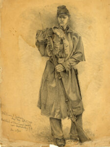
On January 30, 1863, Grant arrived in northeast Louisiana from Memphis to join his Army of the Tennessee in encampments at Young’s Point and Milliken’s Bend. His army was divided into three corps: Maj. Gen. John A. McClernand’s XIII Corps, Maj. Gen. William T. Sherman’s XV Corps and Maj. Gen. James B. McPherson’s XVII Corps. A naval force of ironclad gunboats, transports and assorted craft was anchored north of Vicksburg and commanded by Rear Adm. David D. Porter.
During the winter months, a number of attempts were made to bypass the Vicksburg defenses while the bayous of Mississippi and Louisiana offered passage to transports and gunboats. Several of these involved clever engineering projects. De Soto Point, occupying the land finger in the middle of the Mississippi’s hairpin bend, was the Louisiana rail terminus from which supplies were ferried to Vicksburg. A canal across the neck of the point was started by soldiers in Farragut’s 1862 expedition but then abandoned. Sherman’s men resumed work on the canal, but a rise in water level flooded the work, and the Confederates, learning of the project, placed guns across from the canal’s river return. Two other canal and bayou routes farther north were also explored, but they were found impractical. While all these projects were ultimately scrapped, they did keep Grant’s soldiers busy during the months of winter encampment, preventing boredom and melancholy.
Also in the first quarter of the year, a series of adventures by Porter’s naval force explored dead-end routes to the north, and tested the Vicksburg batteries again. With the coming of spring and drier land in the Louisiana bayous, Grant altered his strategy, planning to march his army down the west bank of the Mississippi. But the gunboats and transports would have to get there too. Learning from the experience of several Federal craft that had run the batteries, Porter prepared to run his gunboats past Vicksburg. On the night of April 16, 1863, the mission was accomplished at the same time that key Confederate officers were attending a grand ball in Vicksburg.
This tour can be started at the Vicksburg National Military Park visitor center on Clay Street, and it will later return here. The sites in the city related to the naval actions described include Fort Hill, a key observation point and artillery position overlooking the Mississippi. It can be reached from downtown Vicksburg by taking Fort Hill Avenue, three blocks east of U.S. Highway 61, and going north. A park road leads from Fort Hill to the USS Cairo museum. There, the only Federal Eads river gunboat that still exists has been partially reconstructed. Although not involved in Grant’s second Vicksburg campaign, the gunboat and adjoining museum give a unique look into the river warfare so vital to the Union conquest of the Mississippi. Noted Civil War historian and Vicksburg expert Edwin C. Bearss discovered Cairo in the 1960s near Yazoo City, Miss., where it was buried in river mud after being sunk by Rebel torpedoes on December 12, 1862. It was painstakingly transported and reconstructed to be a permanent exhibit at Vicksburg NMP.
The circle tour continues south of Vicksburg. Proceed south on U.S. 61 to the Mississippi River bridges. Historical markers and cannon emplacements indicate other Confederate water batteries. South Fort was built to oppose Federal forces reentering the Mississippi if “Grant’s Canal” had been successful in bypassing upriver batteries. An optional trip across the Mississippi on Interstate 20 leads to the Louisiana sites of Grant’s Canal, a part of Vicksburg NMP off exit 186 at Delta, and Winter Quarters State Historic Site (U.S. Highway 65 exit; go 26 miles south and then east on Louisiana Route 4 to Newellton; continue east on Louisiana Route 608). This park contains an 1850 plantation house used as a headquarters by Grant as his infantry arrived at Hard Times, La., in preparation for crossing the river. A number of other antebellum plantation houses are on the route as well.
Back on the Mississippi side, continue south on U.S. 61. Ten miles south of Vicksburg, a historical marker indicates Brierfield, where Jefferson Davis and his brother Joseph maintained a plantation on Davis Island in the Mississippi. The island is privately owned and inaccessible; the plantation has been destroyed over the years. Continue south to the turnoff for Grand Gulf, Miss. Route 462, and go west to the river. Grand Gulf was the place where Grant hoped to ferry the first of his forces, McClernand’s corps, across the river from Hard Times. But the Rebels had constructed two forts there, and a force under a capable Southern commander, Brig. Gen. John S. Bowen, was rushed to the scene. On April 29, Porter’s gunboats engaged the forts, but Fort Cobun on the river’s edge was judged to be too strong, and Grant was forced to look farther south.
Grand Gulf Military Monument is a state park that covers 400 acres and includes trails, a picnic area and RV campsites. There are remains of Forts Cobun and Wade, an excellent Civil War museum, period vehicles and remnants of the town that was hard-hit by disease and flooding before the war. Contact information on Grand Gulf and other sites mentioned is listed on P. 59. From Grand Gulf return east on Mississippi 462, south on U.S. 61 to Port Gibson, through town, then west on Mississippi Route 552 to the historical marker for Bruinsburg. An informant told the Federals of a good road from this point to the interior. Grant’s lead infantry began to land here on April 30, and during the next 24 hours one of the largest amphibious operations prior to D-Day was staged unopposed on the banks of the Mississippi.
From Mississippi 552, turn back east on Russum Westside Road (Historic Rodney Road) past the ruins of Windsor Presbyterian Church and Bethel Presbyterian Church. Both structures witnessed the march of McClernand’s lead brigades on their night advance. Just past midnight, Brig. Gen. Martin Green engaged these brigades near the A.K. Shaifer house. The Rebels continued stubborn resistance here and along the Bruinsburg Road (Mississippi 552 to the north). Outnumbered, the Confederates withdrew in the early evening of May 1, and the Battle of Port Gibson was over. The A.K. Shaifer House and markers describing the first shots fired in the ravines around it stand about eight miles east of Bethel Church.
In the charming town of Port Gibson are many historic buildings, including the boyhood home of Confederate General Earl Van Dorn. A number of houses of worship on U.S. 61 reflect Claiborne County’s diverse culture, and nearly all date from before the Civil War. Proceed a short distance south of Port Gibson on U.S. 61 (or east on Mississippi Route 18) to the Natchez Trace Parkway. This is a scenic route that roughly follows the advance of Grant’s columns northeast toward Jackson.
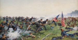
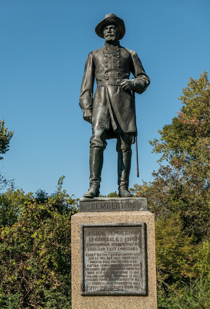
Rather than advance directly north to fortified Vicksburg, Grant chose to move northeast and cut the railroad linking Vicksburg with the capital, isolating Lt. Gen. John C. Pemberton’s garrison. At Raymond on May 12, McPherson’s corps ran into Confederates under Brig. Gen. John Gregg, the vanguard of a force hurriedly assembled under General Joseph E. Johnston to relieve Vicksburg. The Federals struggled in McPherson’s first major battle as a corps commander, but pushed forward on the road to Jackson.
Exit the Natchez Trace Parkway on Mississippi Route 467 and go southeast to the village of Raymond. The battle area was along Fourteen-Mile Creek on Mississippi 18 southwest of Raymond. The Confederate Cemetery is on Dry Grove Road. The elegant Hind County Courthouse at the center of town was used as a signal station and hospital. Proceed on the Raymond-Jackson Road to the Mississippi capital.
By the time Pemberton advanced east from the Vicksburg defenses, Grant had all three corps in the vicinity of the state capital. While the XIII and XVII corps guarded against Pemberton’s advance at Raymond and Clinton, Sherman, whose corps was the last to arrive after the Federals established a base at Grand Gulf, advanced on Jackson. Johnston arrived in Jackson on May 13 and, seeing Gregg’s men on their retreat from Raymond, wired Richmond, “I am too late.” He decided to evacuate the capital. The next day Gregg fought a rear-guard action against Sherman and part of McPherson’s corps.
The Mississippi capital has a wealth of Civil War memories in its buildings and streets, and was involved in several campaigns. The May 14 action took place in the vicinity of the intersection of Raymond Road and Terry Road and around Livingston Park on Clinton Boulevard northwest of Jackson. Many Jackson buildings, including the Old State Capitol, Governor’s Mansion, City Hall, Oaks House and Manship House, survived three separate Federal burnings of the city. The contact information listed on P. 59 provides more sources for Jackson points of interest.
If time permits, rather than taking Interstate 20 directly west to Vicksburg, U.S. Highway 80 affords two more important stops. Just east of Edwards (Edwards’ Station), Pemberton—deciding to continue defending Vicksburg rather than withdraw with Johnston, as the senior commander proposed—threw up a defensive line on a ridge behind Jackson Creek. Unfortunately for the Confederates, the bulk of Grant’s army was approaching from the north and hit Pemberton’s left flank on Sid Champion’s farm. Charging south, elements of McPherson’s and McClernand’s corps swept the Rebels back in the May 16 Battle of Champion Hill.
Follow Old Highway 80 (frontage road to I-20) to Bolton. Just to the west there are historical markers for the battle on Champion Hill Road, Jackson Road and Mississippi 467 (Raymond Road). A short distance east of Buck Reed Road on Mississippi 467 is the Coker House (it was used as a hospital) and a monument to Confederate Brig. Gen. Lloyd Tilghman, who was killed while covering the Confederate retreat on Raymond Road. The Champion Hill battlefield can also be reached by exiting I-20 at Edwards and going east.
Continuing west on U.S. 80, the Big Black River Bridge battle was fought just east of the river on May 17. This was the last rear-guard action prior to the Confederate retreat into the Vicksburg defenses.
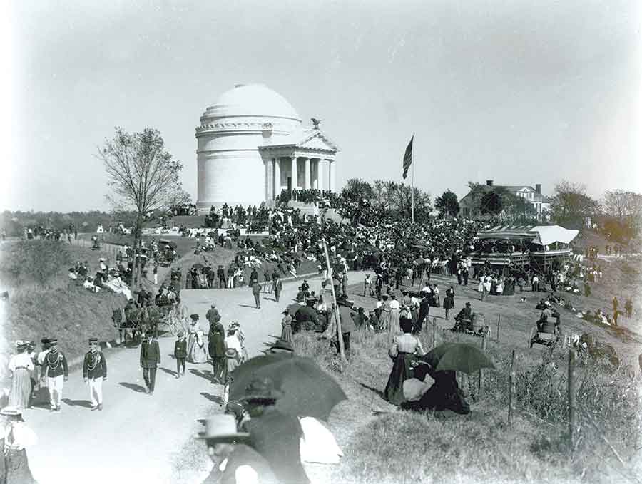
Return to Vicksburg via I-20 or U.S. 80. The main entrance and visitor center for Vicksburg National Military Park is at 3201 Clay St., U.S. 80, near exit 4B of I-20. The visitor center has many exhibits and a film. The park guide map gives directions to most of the military landmarks in the two Federal assaults on May 19 and 22, the siege lines, the location of the Federal gallery and sites related to the surrender of the Confederate garrison on July 4, 1863. The park is expansive, and among the places to see are Stockade Redan, the Shirley House and the site of surrender discussions between Grant and Pemberton.
In addition to Vicksburg NMP, the city has a number of other sites from the antebellum and Civil War periods. The Warren County Courthouse was built in 1858 on Vicksburg’s highest point and contains the Old Courthouse Museum, which focuses on life during the siege. A number of other buildings, including shops, restaurants and accommodations, are in historic buildings. Vicksburg, the route of the Federal advance and the battlefields of the 1863 campaign are slices of Civil War history that must be seen at least once as one tracks down the past.
Originally published in the February 2006 issue of Civil War Times.