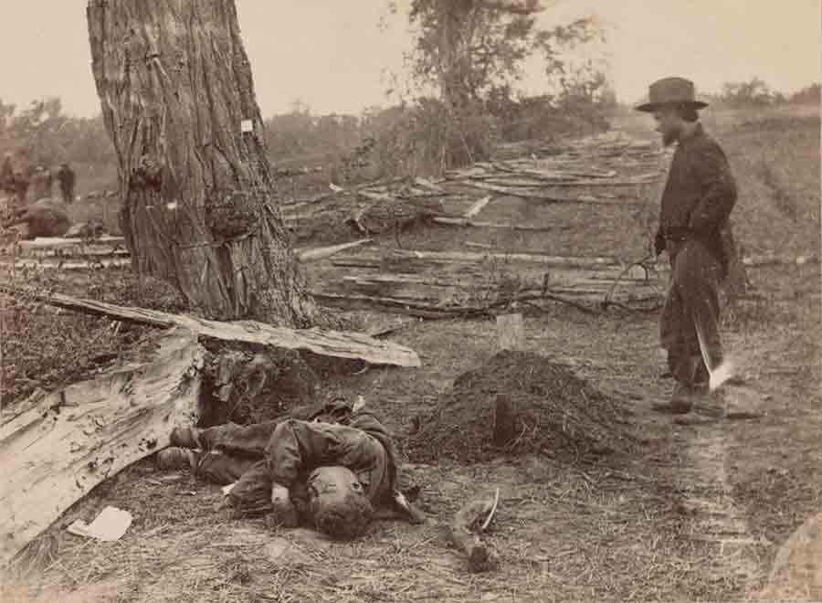
Restoration efforts let visitors see hallowed ground as it was in 1862

[dropcap]F[/dropcap]or many years Antietam National Battlefield owned outright only a small portion of the 3,200 acres within its boundaries. In many places, narrow rights-of-way allowed visitors to see, but not walk, terrain that had been soaked by Union and Confederate blood on September 17, 1862. Fortunately, that has finally begun to change with the recent purchase of several tracts of land vital to interpreting the battle.
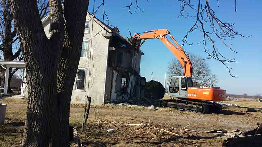
The Civil War Trust in partnership with the Save Historic Antietam Foundation has spent more than $2 million in the past two years to purchase four properties totaling roughly 60 acres on the northern portion of the battlefield. Beyond those purchases, SHAF and CWT have spent thousands of dollars more to restore these properties to their wartime appearance. That included demolition of three nonhistoric houses, three nonhistoric barns, and several smaller outbuildings. Volunteers from SHAF and other organizations also removed a large and dense nonhistoric tree line, greatly enhancing the view of the area between the East Woods and West Woods.
So much preservation in such a short period is unprecedented for a major Civil War battlefield. The success at Antietam highlights the support the Trust provides local groups such as SHAF. Their achievements and ongoing efforts bolster the National Park Service’s ability to integrate these areas into the larger battle narrative.
Perhaps the most important acquisition is the 44-acre triangular property bordered by the Hagerstown Pike, the Smoketown Road, and Cornfield Avenue known as the Wilson Farm. Originally part of the David R. Miller Farm, this land just south of the famous Cornfield was subdivided after the War Department constructed Cornfield Avenue in the early 20th century. It was the scene of intense fighting early in the battle and experienced more casualties than the Cornfield itself. Until this restoration, it was the metaphorical “hole in the doughnut” as the only privately owned plot in the heart of the battlefield. An extraordinary panorama of the pivotal battleground can now be seen, allowing visitors and historians to experience the terrain as it was that awful September day.
Tom Clemens has edited and annotated the three-volume The Maryland Campaign of September 1862 (Savas Beatie), and is a founder and president of the Save Historic Antietam Foundation.